DRONE SERVICES
We offer a variety of drone services from basic imagery capture to layered terrain models.
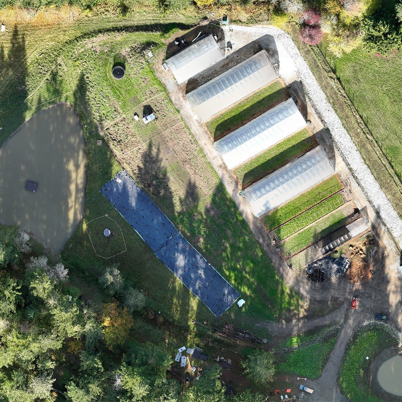
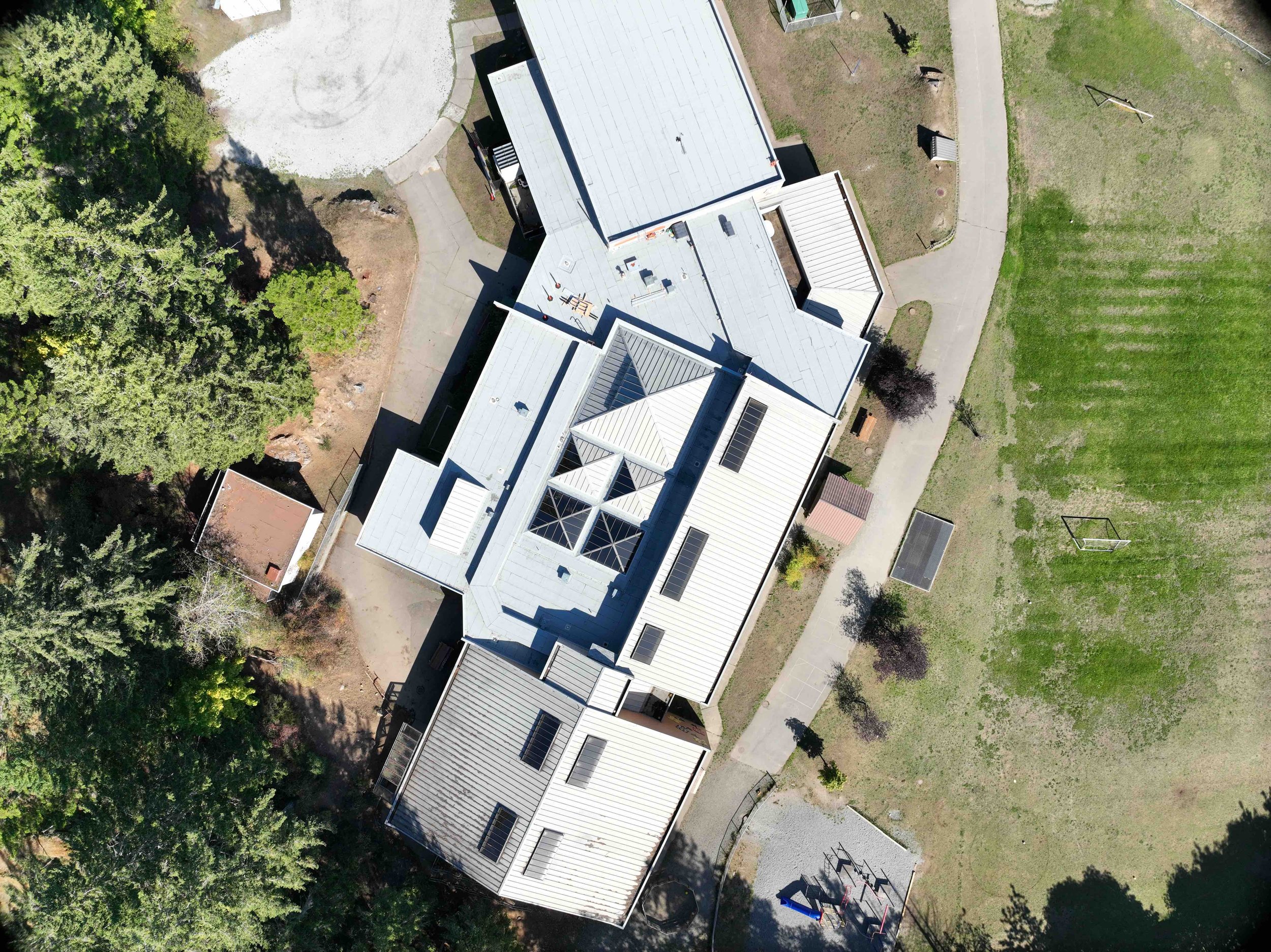
HIGH RESOLUTION IMAGERY
Drone imagery enables a crystal clear ‘birds eye view’ for detailed site analysis, project tracking or real estate media.


SATELLITE

DRONE
View up to date imagery of your site to replace fuzzy satellite imagery. We’ll provide Google Earth Pro friendly files for easy viewing.
TOPOGRAPHIC DATA CAPTURE
A combination of advanced drone hardware & software allows us to extract high resolution elevation data from georeferenced imagery.

CLICK IMAGE ABOVE TO VIEW TOPOGRAPHY
DETAILED SITE ANALYSIS
Gain unique perspectives with a variety of visual models including terrain, water flow patterns, potential solar exposure & percent slope.

HILLSHADE MODEL & ELEVATION CONTOURS

SOLAR ASPECT

TOPOGRAPHIC WETNESS INDEX
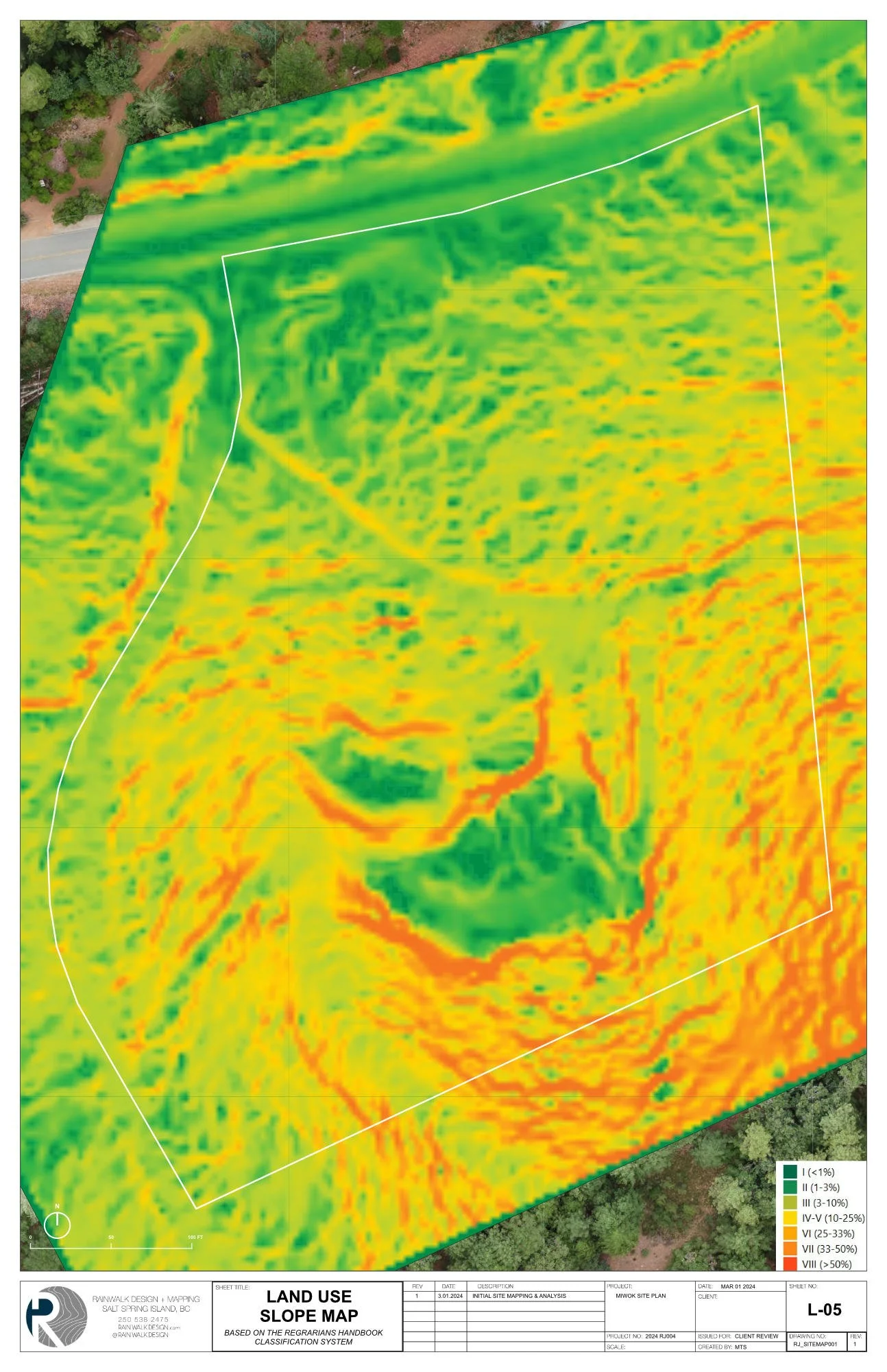
LAND USE SLOPE MAP
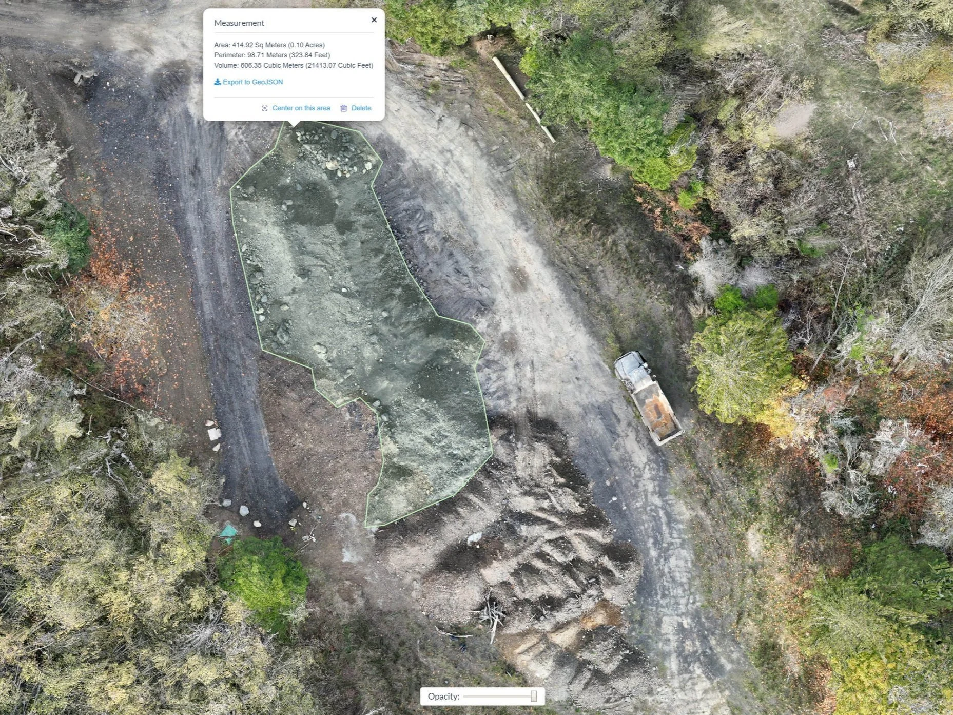
STOCKPILE MEASUREMENTS
Accurate stockpile measurements aid in decision making & project tracking.

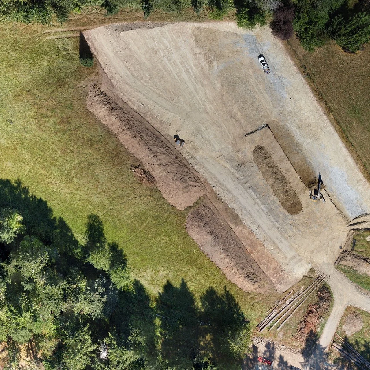
PROJECT TRACKING
Track progress, make measurements & spot potential kinks with high-resolution orthophotos.
MAPPING PACKAGES
Our drone pilots are certified by Transport Canada
BASIC
Great for visual inspections, project tracking, event maps & real estate where relative accuracy is all that’s needed.
OUTPUTS:
Orthomosaic Image: High-resolution map with 2.5 cm/px GSD or under. (.geoTIFF)
Photos & Videos: (.jpeg .mp4)
STANDARD

We utilize an RTK/PPK workflow to collect highly accurate geographic positional data. This is necessary for creating site plans, measuring stockpiles, building 3D models & integrating existing geo-referenced survey data.
OUTPUTS:
Orthomosaic Image: High-resolution map with 2.5 cm/px GSD or greater. (.geoTIFF)
Elevation Contours: At 1ft, 2ft & 3ft intervals (.kmz .shp)
NOTE: Interpolation will be necessary in areas with > 60% forest cover to create bare earth DEM’s. Accuracy of elevation contours may vary in forested areas.
Digital Terrain Model, DTM (.geoTIFF)
Digital Surface Model, DSM (.geoTIFF)
OPTIONAL ADD-ONS:
Optimized Elevation Contours with reduced noise & artifacts (.kmz .shp)
3D Model (.obj)
Point Cloud (.laz .las)
Photos & Videos: (.jpeg .mp4)
PRECISION

Multiple ground control points (GCP’S) are placed on site for projects requiring the highest level of positional accuracy.
OUTPUTS:
Same as STANDARD with higher positional accuracy.